


West Virginia Shaded Relief State Wall Map
West Virginia Shaded Relief State Wall Map - 38" x 31.5" / Paper is backordered and will ship as soon as it is back in stock.
Print-on-Demmand Delivery Lead Times
Print-on-Demmand Delivery Lead Times
This item is printed and assembled on demand according to your specific requirements. Printed and laminated maps typically take up to 4 weeks to ship, while mounted maps may take up to 6 weeks. We always strive to place each order into our production queue as quickly as possible to minimize any delays.
Shipping & Returns
Shipping & Returns
Free Shipping
Orders $100+ qualify for FREE Shipping within the Continental USA learn more
Returns & Exchanges
Print-on-Demand Wall Maps are non-returnable. learn more
Warranty
Warranty
This item includes a 90-Day Manufacturers Limited Warranty that covers manufacturing defects from the time of purchase. For assistance with a warranty claim or question please contact our Customer Support department.
West Virginia Shaded Relief State Wall Map
Description
Description
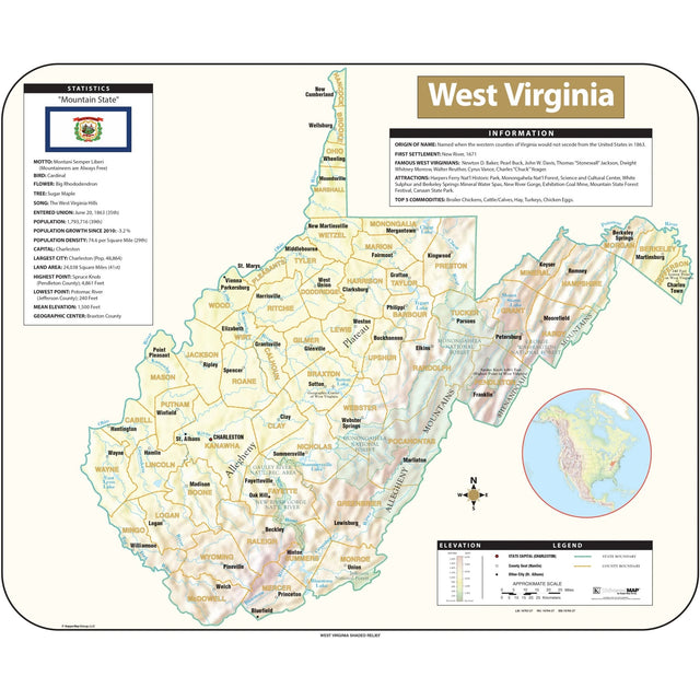
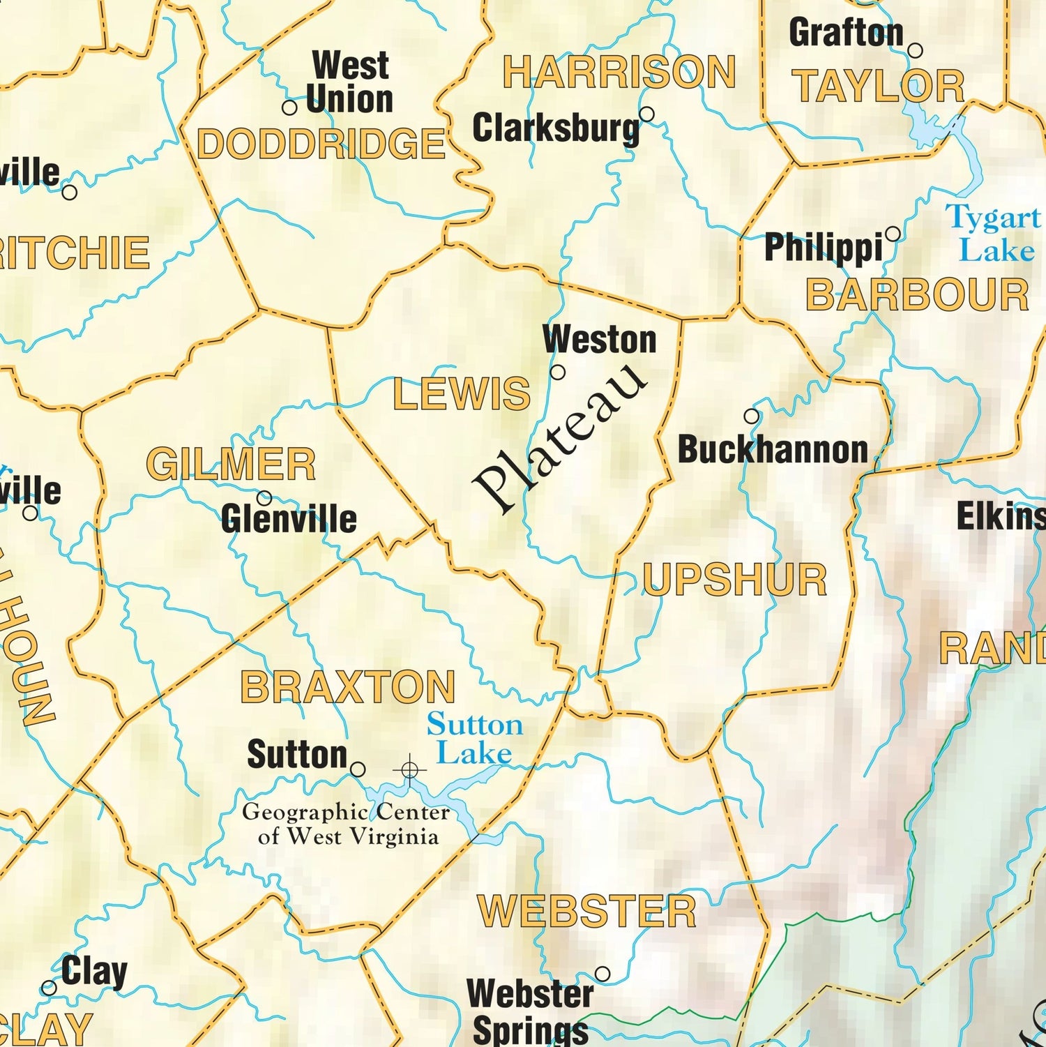
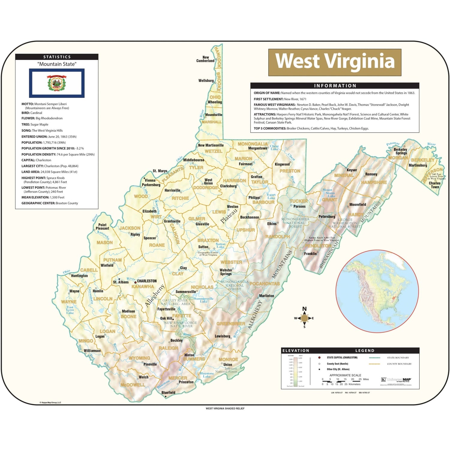
The West Virginia Shaded Relief Topographical Wall Map by Universal Map includes historical, anecdotal, and geographical information, an elevation scale measured in meters and feet, and a distance scale measured in miles and kilometers. Identifies county boundaries, state flag, motto, bird, flower, and tree, plus total area, population, and origin of name.
Sizes: 63" x 52" | 50.5" x 42" | 38" x 31.5"
Published: 2016
-

PAPER
Paper finishing is the most economical option. Most maps are printed on premium 36lb paper. Waterproof paper is also available for functional maps that may be used outdoors.
-

LAMINATED
Maps are printed then run through our laminator that secures 1.7mil-thick satin-gloss-finished lamination on the front and back. Use map stickers and wet-erase markers.
-

MOUNTED
Maps are printed then laminated with 1.7mil-thick satin lamination onto 1/4″-thick foamcore. You can use map pins, stickers, or wet-erase markers with our mounted maps.
-

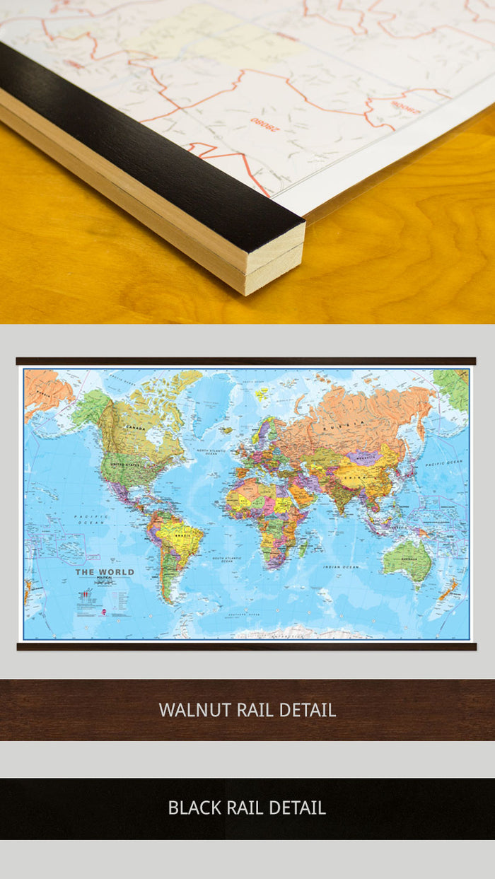
LAMINATED WITH RAILS
First, we laminate the map then we mount wood rails at the top and bottom of the map. The front side of each rail is finished with a black or walnut finish while the sides and back are unfinished wood.
Sawtooth hardware is fixed to the back of the top rail, so it’s ready to hang. Use stickers or wet-erase markers on your map.
-

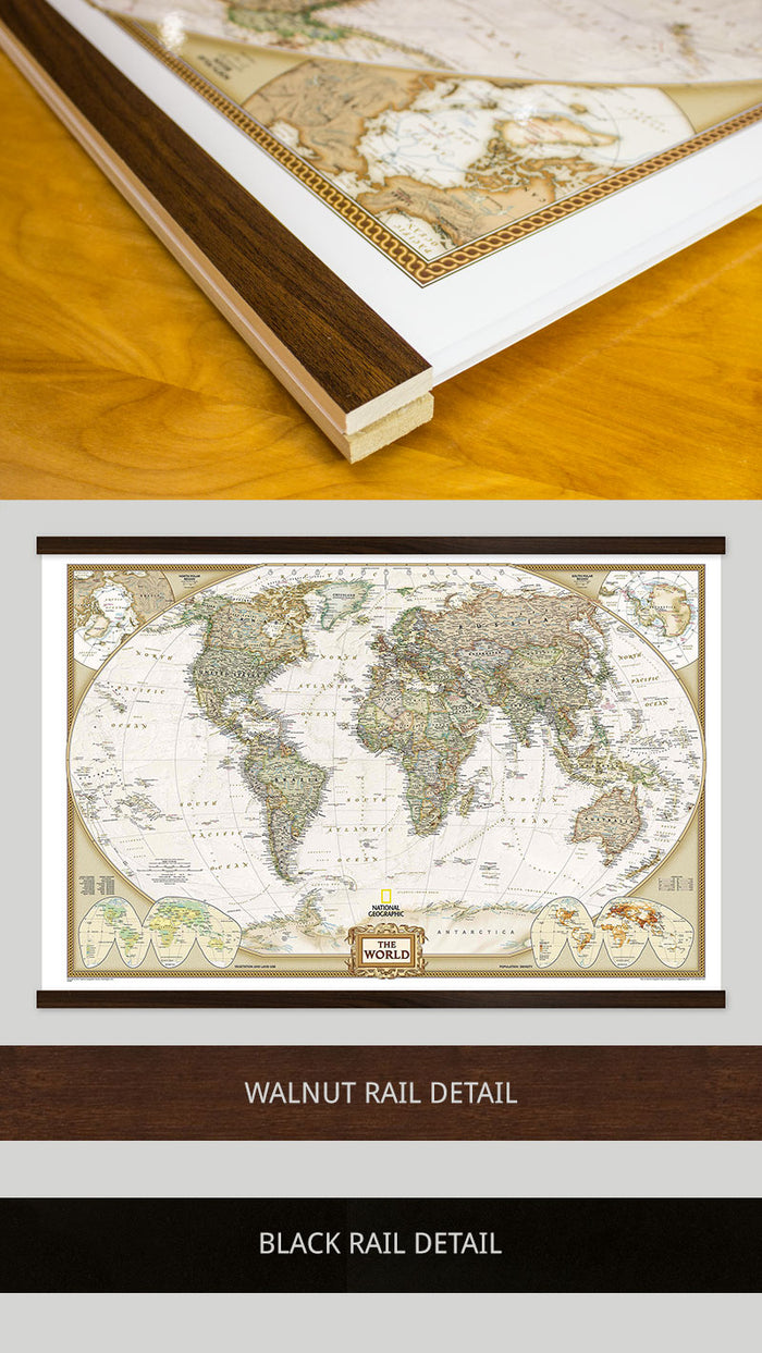
MOUNTED WITH RAILS
First, we laminate the map onto foam core then we mount wood rails at the top and bottom of the map. The front side of each rail is finished with a black or walnut finish while the sides and back are unfinished wood.
Sawtooth hardware is fixed to the back of the top rail. Use map pins, stickers, or wet-erase markers on your maps.
-

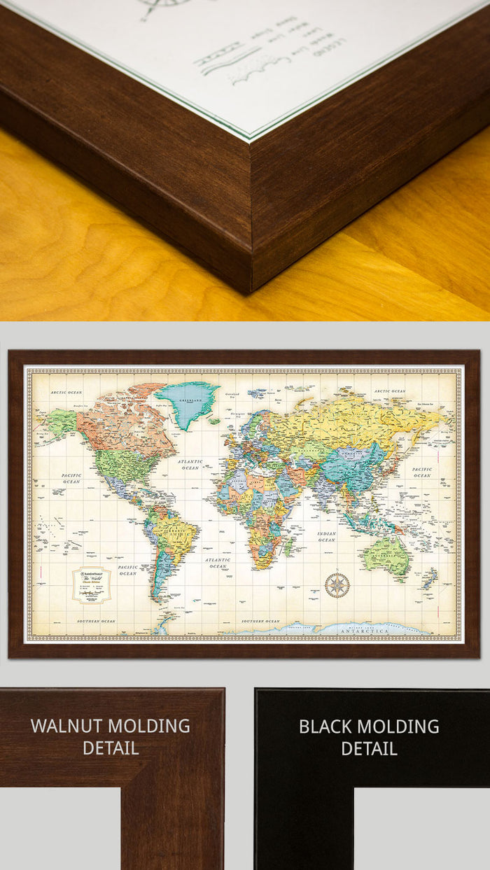
FRAMED
Maps are laminated onto foam core then secured into the frame. The engineered molding is made from recycled wood in either a black or walnut-finish that wraps around the whole frame to the back.
Sawtooth hardware is fixed to the back of the top. You can use map pins, stickers, or wet-erase markers on all our framed maps.

SPRING ROLLER
The map is laminated then installed on a spring roller. If you do not have an existing mounting for this size we suggest you order the spring roller and backboard option.